


The Man Behind the Map: Who Was Piri Reis?

Piri Reis was a distinguished naval officer and skilled mapmaker of the Ottoman Empire, born around 1465 or 1470 in Gallipoli, a port city on the Dardanelles strait. He began a seafaring life at a young age, first as a government-supported privateer and later as part of the Ottoman navy, where he rose through the ranks to become an admiral.
The content of his map reveals the serious research he undertook as he prepared to create it, his familiarity with navigation, and his access to the most recent reports of exploratory voyages. He was not simply drawing from imagination. Reis was an admiral in the Turkish navy, an experienced sailor, and a cartographer, who claimed to have used 20 source maps and charts to construct the map, including 8 Ptolemaic maps, 4 Portuguese maps, an Arabic map, and a map by Christopher Columbus.
Much of Piri Reis’s biography is known only from his cartographic works, including his two world maps and the Kitab-ı Bahriye, or “Book of Maritime Matters,” completed in 1521. He had sailed with his uncle Kemal Reis as a Barbary pirate until Kemal Reis received an official position in the Ottoman Navy in 1495.
Rediscovery: A Forgotten Parchment in Istanbul
On October 9, 1929, a German theologian named Gustav Adolf Deissmann was cataloguing items in the Topkapi Palace library in Istanbul when he came across a curious parchment among some disregarded material. On the gazelle skin parchment was a map, now referred to as the Piri Reis map, drawn and signed by Turkish cartographer Hagji Ahmed Muhiddin Piri, dated to 1513 AD.
When rediscovered in 1929, the remaining fragment garnered international attention as it includes a partial copy of an otherwise lost map by Christopher Columbus. That detail alone would have made it remarkable. The map is drawn on parchment made from gazelle skin, and the surviving map fragment measures 35 by 24 inches.
After Piri presented the work to Sultan Selim I following the 1517 Egypt campaign, the map disappeared from view until 1929, when scholars cataloging Topkapı’s library brought the fragment to light. Four centuries of silence, and then, almost by accident, one of the most controversial cartographic discoveries in modern history.
What the Map Actually Shows

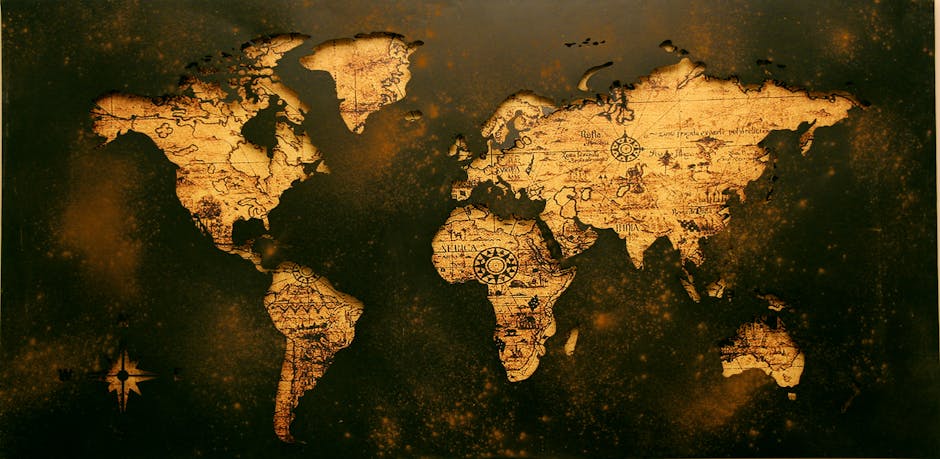
The map is a portolan chart with compass roses and a windrose network for navigation, rather than lines of longitude and latitude. It contains extensive notes primarily in Ottoman Turkish. The depiction of South America is detailed and accurate for its time.
The surviving sheet centers the Atlantic with the coasts of Europe and Africa at right and the eastern coasts of South America and the Caribbean at left. Compass roses radiate rhumb lines typical of portolan navigation. The sheet is richly illustrated and annotated, blending Islamic miniature aesthetics with European discoveries.
The extant section represents roughly one-third of the original, which would probably have shown the entire world as known in the early sixteenth century. The bottom portion of what survives is what triggers all the controversy. A southern landmass extends from the lower edge of the parchment, and its identity has never been definitively settled.
The Antarctica Claim: How It Started
Since its discovery, the Piri Reis map has stirred both intrigue and controversy, mostly due to the presence of what appears to be a representation of Antarctica around 300 years before it was discovered. Another, perhaps even more intriguing facet is that it appears to show the landmass before it was covered in ice. The great debate was sparked by Professor Charles Hapgood when he published his theory on the Piri Reis map in his book “Maps of the Ancient Sea Kings” in 1965.
Professor Hapgood, based at the University of New Hampshire, had studied the Piri Reis map with his students and found several things they could not explain. Not only was there the issue of Antarctica without its ice cap, but they noticed that the map was drawn using the Mercator Projection, a methodology not used by European cartographers until the late 16th century.
Professor Hapgood and his students theorized that the Piri Reis map had to have been based on information older than 4,000 BCE. This is long before any known sophisticated civilizations or any well-defined languages, and the map introduces the theory of an ancient civilization that had the skills to navigate the world’s oceans and accurately chart the lands they visited.
Hapgood’s Evidence and the Air Force Letters
Writing to the United States Air Force, Hapgood asked if there was any correlation between geographical details on the Piri Reis map and results of seismic findings conducted by the Swedish-British-Antarctic Expedition of 1949. The report showed high correlation between Antarctica under the ice and large portions of the map, with correspondence to fifty-five specific geographical locations on the continent.
Letters from an Air Force cartography section stationed at Westover AFB in 1961 state that at Hapgood’s request, they had studied both the Piri Reis and Oronce Finé maps during their off-duty hours, concluding that both were compiled from original source maps of Antarctica at a time when it was relatively free of ice, supporting Hapgood’s findings.
Hapgood concluded that advanced cartographic knowledge on the map must be the result of some unknown ancient civilization that developed advanced scientific knowledge before other civilizations such as Greece. According to historians Paul Hoye and Paul Lunde, while Hapgood’s work garnered some enthusiasm and praise for its thoroughness, his revolutionary hypotheses largely met with skepticism and were ignored by most scholars.
The Terra Australis Explanation: A Rival Theory
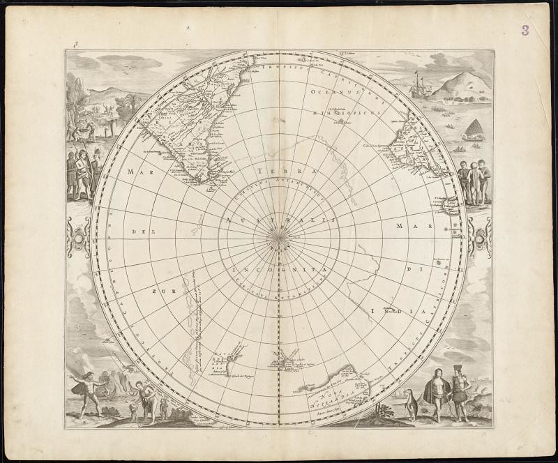
The southern continent stretching across the map is most likely Terra Australis. Some authors have claimed that it depicts areas of South America not officially discovered in 1513, and a popular but disproven hypothesis alleges it to be Antarctica. Maps of the period generally depicted this theoretical southern continent, in various configurations.
This land was posited by Roman geographer Ptolemy as a counterbalance to the extensive land areas in the known world. As explorers charted the Southern Hemisphere, it pushed back the potential bounds of Terra Australis. In other words, the southern landmass on the Piri Reis map may simply be what every educated 16th-century cartographer felt obligated to include.
Classical Greek cartographers originally proposed the existence of a southern continent due to the belief that landmasses must be “balanced” at either end of the globe. Therefore, one must exist in the southern hemisphere to balance those in the northern hemisphere. Due to this incorrect belief, many sixteenth-century cartographers included an invented landmass in the southern hemisphere, despite having no proof of the existence of one.
What Geologists and Ice Core Data Actually Say

According to geologist Paul Heinrich, Hapgood’s analysis mistakenly conflates the topography of Antarctica below the ice with a hypothetical ice-free Antarctica. It does not take into account post-glacial rebound, where land rises after massive ice sheets melt away. Additionally, the 1949 survey could not measure even one percent of the area drawn in the Piri Reis map.
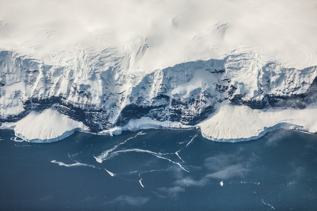
Hapgood mistakenly believed that Antarctica had been free of ice in 17,000 BC and partially ice-free as late as 4,000 BC, a date range that could have put the mapping of Antarctica contemporary with many known prehistoric societies. More recent ice core data shows that Antarctica was last free of ice over ten million years ago.
Subsequent studies with access to more data have shown no significant similarities to Antarctica’s coast beneath the ice or a projected Antarctic coastline without ice. This is one of the most decisive findings in the entire debate, and it tends to be underreported outside academic circles.
The South America Coastline Argument

Skeptics of Hapgood’s theory point out that the map is a representation of the South American coastline, pointing to modern physical features of the coast and interior included on the 16th-century map. Otherwise, argue critics, the image would indicate that Antarctica and South America had once been connected at Uruguay, and that Argentina did not yet exist.
What many believed to be an ice-free depiction of Antarctica is actually nothing more than the South American coastline. Some researchers hypothesized that Piri Reis simply ran out of room to draw on the gazelle skin. In his notes, he states this region is “very hot” and “full of snakes.” While these descriptions certainly wouldn’t fit what they knew about Antarctica at the time, they could very well describe the Amazon Jungle.
A southern continent on an old map can be evidence of a worldview, not evidence of a voyage. The “ice-free” claim often rests on a stacked assumption: first that the landmass is Antarctica, and second that the detail represents bare ground rather than a stylized coastline. If either assumption fails, the extraordinary conclusion collapses into ordinary cartographic history.
Scholarly Assessment and the Limits of Hapgood’s Case
In the book “The Piri Reis Map of 1513,” scholar Gregory C. McIntosh examines Hapgood’s claims for both maps and states that they “fall short of proving or even strongly suggesting that the Piri Reis map and the Fine map depict the actual outline of Antarctica.”
The scientific and historical communities largely reject the “Antarctic theory.” Skeptics point to several flaws in the interpretation. When compared to modern maps, the similarities are often attributed to selective interpretation and the use of cartographic projections that can create misleading alignments. Furthermore, the claim of an ice-free Antarctica is also problematic, as the notion of a readily accessible and mapped ice-free Antarctica before the 19th century is unsubstantiated by geological and historical evidence.
Claims that the map shows Antarctica ice-free are not supported by cartographic scholarship. That verdict, from UNESCO’s own assessment, carries considerable weight. Still, the debate hasn’t fully closed, partly because the map does contain genuine anomalies that mainstream cartographic history struggles to account for neatly.
The Antediluvian Framing and Popular Culture

Writers like Erich von Daniken, Donald Keyhoe, and Graham Hancock have uncritically repeated Hapgood’s claims as proof of ancient astronauts, flying saucers, and a lost civilization comparable to Atlantis, respectively. The map became, for a generation of readers, shorthand for hidden history.
Old maps did not emerge from a single survey. They emerged from compilation: ports, sailors’ notes, travelers’ sketches, rumor, and earlier maps. Compilation is powerful, but it’s also how errors propagate. One mistaken coastline can become canon if copied enough times, especially when the copier is more concerned with completeness than verification.
Some cartographers of the time speculated or extrapolated landmasses based on limited data, sometimes filling in gaps with educated guesses. The Piri Reis map used multiple sources, and it’s conceivable that at least one of those sources contained speculative geography. That’s the measured, somewhat less exciting truth sitting beneath all the mythology.
What the Map Does Genuinely Prove
The 1513 Piri Reis map dates to the European “Great Age of Discovery” and is one of the best-known early maps to depict the Americas, presenting a cartographic record of the oceanic voyages, expeditions, and discoveries of Christopher Columbus and other early explorers in the last decade of the fifteenth century.
The Piri Reis map of 1513 may be one of the most important maps of the time to have survived because it probably contains a copy of a map made by Columbus, or under his supervision, not in 1498 as previously supposed, but two or three years earlier. That finding alone makes it invaluable to historians of the Age of Exploration.
The map is remarkable for having been created at a time when correct topographic positioning of recently discovered regions was technically exceedingly challenging. The well-known Old World had been explored and mapped for centuries, and the mapping of it was quite accurate. The New World, however, was new and unexplored. Though created centuries before geolocation technology, the map presents new topographical information, much of which is surprisingly accurate.
Conclusion: A Map That Still Earns Its Mystery

The Piri Reis map isn’t proof of a lost ice-age civilization. The science, especially ice core data placing Antarctica’s last ice-free state at over ten million years ago, makes that near impossible to sustain. The southern landmass is most likely a combination of speculative Terra Australis tradition, compressed South American coastline, and the inevitable errors of 16th-century cartographic compilation.
Yet the map remains genuinely remarkable. More than just a historical artifact, it represents a significant cartographic achievement for its time, yet it also harbors mysteries that continue to pique the interest of historians, geographers, and amateur enthusiasts alike. The Columbus connection, the geographic accuracy of the Atlantic coasts, and the sheer scale of the research Piri Reis undertook all deserve more attention than the Antarctica debate tends to allow.
What the map ultimately reflects is how knowledge moves through time: copied, filtered, distorted, and occasionally brilliant, passed hand to hand across languages and empires until it lands, half-intact, on a piece of gazelle skin that a German theologian almost didn’t notice on an autumn morning in 1929.