
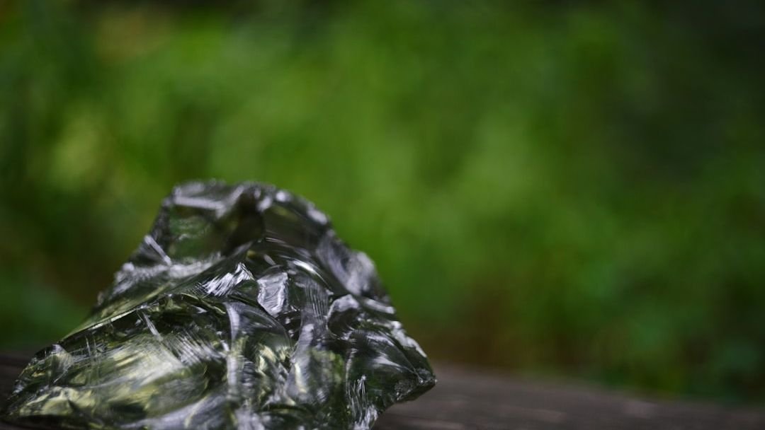
Imagine holding a small, glassy fragment no bigger than your thumbnail. It seems like nothing. A bit of sharp volcanic rock. Yet this tiny sliver carries inside it a secret so staggering it has forced archaeologists to rewrite entire chapters of human history. It proves that long before GPS, steel ships, or even written maps, ancient people were crossing thousands of miles of open ocean, trading, connecting, and venturing into the unknown with a confidence we can barely comprehend today.
This is the story of obsidian. Specifically, the mysterious green and glassy variety that keeps showing up in places it absolutely should not be. The distances involved are not modest. We are talking about journeys that equal sailing from New York to London, or from Australia to Japan, all by canoe. Be surprised by what the rocks have to say.
What Exactly Is Green Obsidian, and Why Did Ancient People Risk Everything For It?
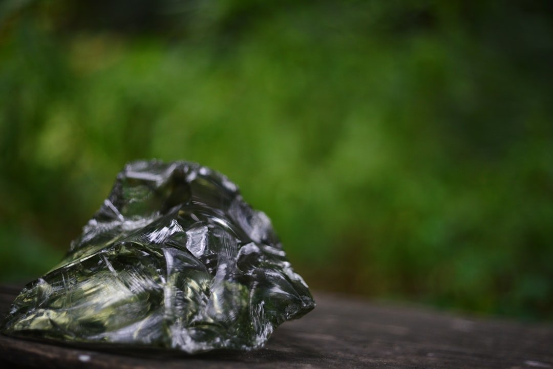
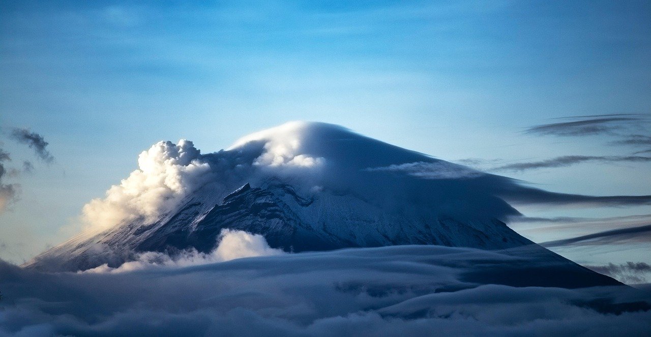
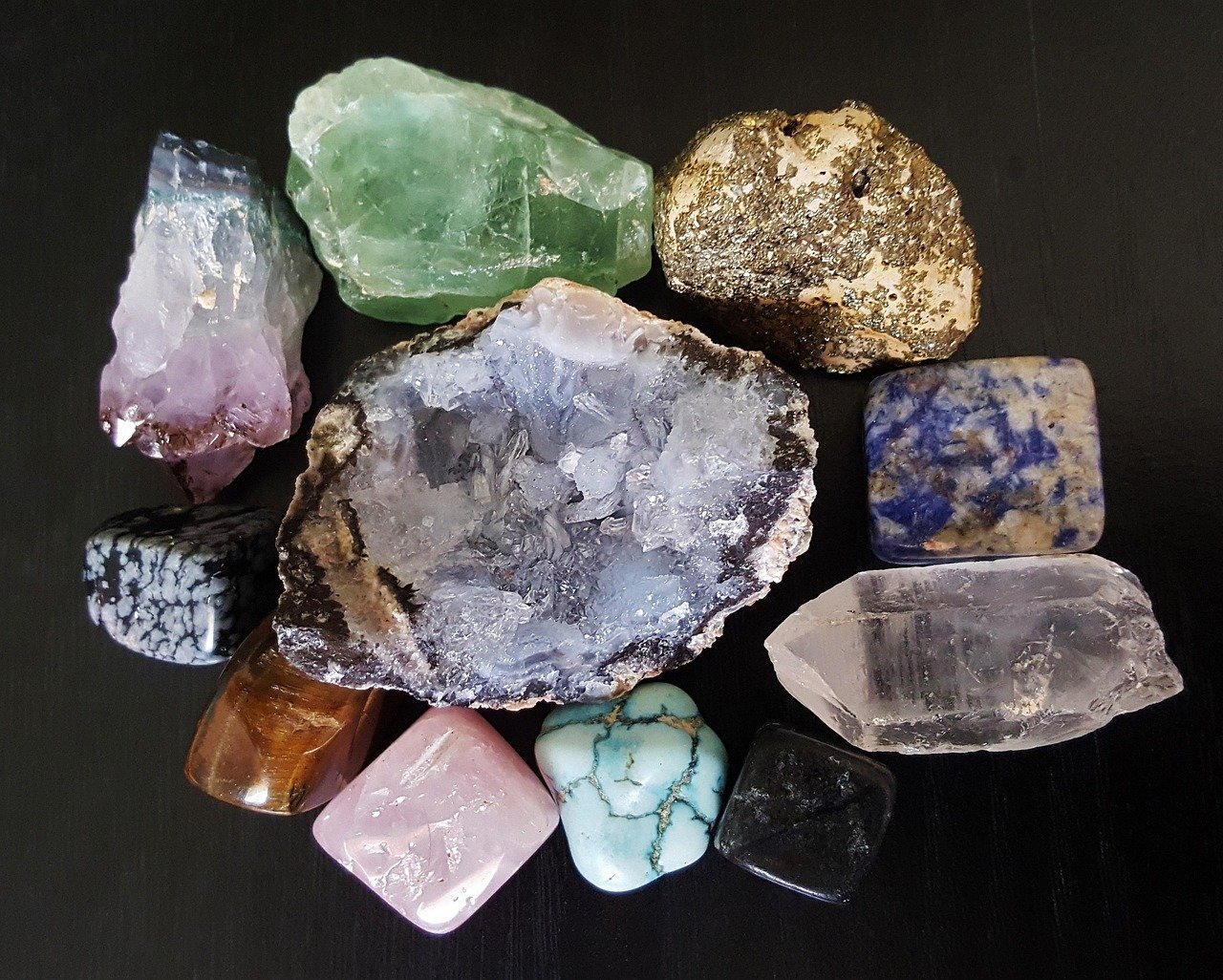
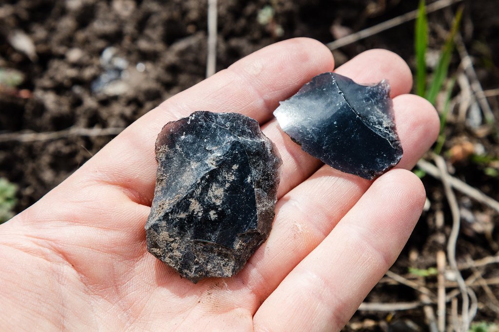
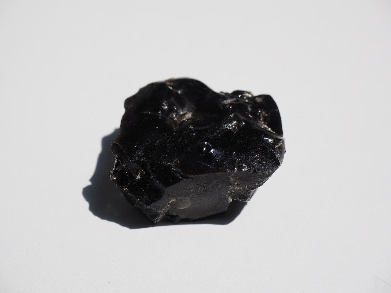
Obsidian is volcanic glass, formed when lava cools so rapidly it has no time to crystallize. Obsidian is a naturally formed volcanic glass that was an important part of the material culture of Pre-Columbian Mesoamerica. The green variety in particular, associated most famously with the Pachuca region of central Mexico, was especially prized. It glowed with an almost supernatural shimmer, and ancient cultures treated it accordingly.
Obsidian was a highly integrated part of daily and ritual life, and its widespread and varied use may be a significant contributor to Mesoamerica’s lack of metallurgy. Honestly, that is a remarkable statement. A single volcanic glass so sharp and so versatile that it partially replaced the entire development of metal tools for centuries.
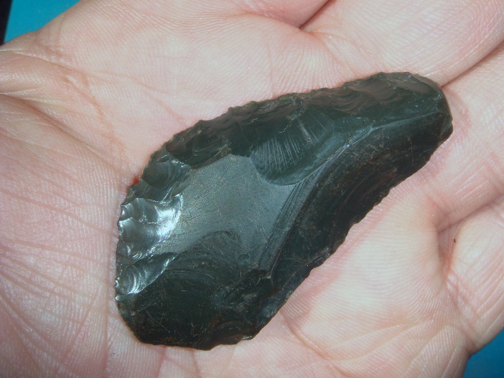
Due to its glassy internal structure, obsidian is relatively easy to work, as it breaks in very predictable and controlled ways via conchoidal fracturing. Think of it like the ancient world’s version of surgical steel. Some obsidian blades held an edge far sharper than modern scalpels. It’s hard to overstate how valuable this material was to people who depended on cutting tools for survival.
The Science of “Fingerprinting” a Rock Across the Ocean
Here’s the thing that makes obsidian archaeology so fascinating. Every volcanic source on earth produces obsidian with a unique chemical identity, almost like a fingerprint. Each of these sources has a distinctive “fingerprint” of trace elements that proportionally vary due to the individual circumstances of each source’s formation. No two volcanic eruptions produce identical glass.
Neutron activation analysis (NAA) and X-ray fluorescence (XRF) are two analytical methods used to identify the types and amounts of trace elements. These data are then statistically compared to data already available for the known sources. Scientists can essentially match a fragment found thousands of miles away back to its precise volcanic home, like genetic testing for rocks.
This is possible because the magma associated with each volcanic eruption is composed of a distinct combination of minerals. Once scientists figure out the distinct combination of minerals associated with the eruptions from each volcano, they can match the makeup of the archaeological artifacts with the minerals from each source. The result? A map of ancient human movement that no one ever physically drew.
The Pacific’s Most Traveled Stone: Talasea Obsidian and the 3,000-Mile Journey
If you want a case study in ancient maritime courage, look no further than the obsidian from Talasea on the island of New Britain in what is now Papua New Guinea. This material was found not just nearby, but across a staggering arc of the Pacific. The Talasea obsidian from New Britain has been found in deposits dating to around 3,000 years ago over a range of 6,400 km west and east of the source. Let that sink in for a moment.
About 3,000 years ago, New Britain obsidian also turned up in Sabah, Malaysia, some 3,380 km to the west. Meanwhile it was simultaneously moving thousands of kilometers to the east. The same stone, the same source, two directions, two oceans, one ancient maritime network.
The direct distance from Talasea to the Isle of Pines is 2,300 km, and about 3,000 km by taking a step-by-step route through the Melanesian chain. Researchers confirmed the obsidian found at early Lapita sites in New Caledonia originated from this exact Talasea source. A tiny fragment of volcanic glass bridging a world.
The Lapita People: The Ancient World’s Greatest Maritime Traders
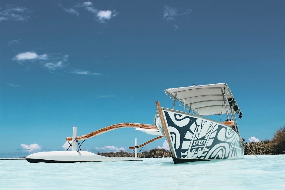
Who were actually doing all this sailing? Meet the Lapita people, arguably the most extraordinary seafarers in prehistoric human history. The Lapita culture is the name given to a Neolithic Austronesian people and their distinct material culture, who settled Island Melanesia via a seaborne migration at around 1600 to 500 BCE. They didn’t just drift. They navigated.
Long-distance trade was practiced; items traded included obsidian, adzes, adze source-rock, and shells. Obsidian was central to their economy. The obsidian quarried by Lapita artisans from Talasea on the Melanesian island of New Britain can be shown to have been among the most far-traded commodities of the Neolithic world. That is not a small claim. This puts Pacific obsidian in the same conversation as Mediterranean copper or Mesopotamian lapis lazuli.
They built large, stable, double-hulled sailing canoes capable of carrying people, plants, and animals on long, open-ocean voyages. More than 200 Lapita sites have since been uncovered, ranging more than 4,000 km from coastal and island Melanesia to Fiji and Tonga with its most eastern limit in Samoa. These weren’t accidental voyages. This was a civilization built on the ocean.
Borneo’s Bombshell: A 3,500-Kilometer Trade Route to an Island With No Volcanoes
In arguably one of the most jaw-dropping discoveries in Pacific archaeology, researchers found obsidian fragments on the island of Borneo at a site called Bukit Tengkorak. I know it sounds crazy, but Borneo has no volcanic obsidian sources of its own. Steven Chia of the Universiti Sains Malaysia began excavating an archaeological site known as Bukit Tengkorak on the island of Borneo. Chia unearthed from under a rock shelter some 200 flecks of obsidian embedded in soil layers dating to 4000 years B.C. Because there are no known obsidian sources near the excavation site, the researchers were eager to see if they could trace the flecks’ origin.
The answer was extraordinary. Chia and Robert Tykot, an archaeologist and chemist at the University of South Florida, analyzed the amounts of 11 different compounds in the Bukit Tengkorak obsidian flecks. They found that the majority of flecks had a chemical fingerprint matching well-known obsidian sources some 3,500 kilometers away, near the island of New Britain and the Admiralty Islands.
The findings suggest that Neolithic peoples in the southwest Pacific set up what would have been the world’s longest Stone Age trading route. Think about that. A trade network that, by distance alone, rivals a modern transatlantic crossing. Maintained, apparently, over generations. Without a compass.
Under the Great Lakes: Oregon Obsidian Found 2,500 Miles From Home
Long-distance obsidian travel wasn’t only a Pacific phenomenon. In North America, underwater archaeologists made a discovery that completely reframed our understanding of ancient continental trade. Underwater archaeologists have been studying 9,000-year-old stone tool artifacts discovered in Lake Huron that originated from an obsidian quarry more than 2,000 miles away in central Oregon.
The artifacts found below the Great Lakes come from a geological source in Oregon, 4,000 km away, making it one of the longest distances recorded for obsidian artifacts anywhere in the world. Nine thousand years old. These people were moving materials across what is now the entire western half of North America long before any civilization we typically discuss in textbooks.
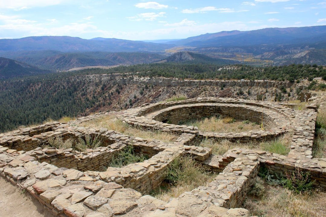
The obsidian flakes from the underwater archaeological site represent the oldest and farthest east confirmed specimens of western obsidian ever found in the continental United States. The site itself was submerged 8,000 years ago as glaciers melted. It would have remained above the water level for about 2,000 years after the glaciers retreated, and in those centuries, it was inhabited by a Native American group that built their own unique culture.
Green Obsidian and the Mesoamerican Pacific Trade Highway
Back to that distinctive green glow. In Mesoamerica, green obsidian from the Pachuca highlands became the signature of power and prestige. Obsidian from Pachuca, located in present-day Mexico, was distributed throughout Mesoamerica, reaching the Maya, Olmec, and Toltec civilizations. Reaching, really, almost every corner of the pre-Columbian world.
The results of portable X-ray fluorescence (pXRF) analysis of 456 obsidian artifacts imported to the Pacific Coast site of La Zanja, Guerrero, Mexico, indicate that long-distance exchange of finished obsidian blades along the coast began during the Early Formative period around 1400 to 1000 cal BC and remained constant into the Middle Formative Period around 800 to 550 cal BC.
Comparisons with sourcing studies from elsewhere in Mesoamerica indicate the development of a major Pacific Coast trade network during the Formative Period that linked coastal Guerrero to the central Mexican highlands and the Valley of Oaxaca. This was not casual gift exchange between neighboring villages. This was organized, sustained, long-distance commerce. Millennia before Columbus.
How Did They Actually Navigate? Stars, Birds, and Deep Ocean Knowledge
The question that haunts every researcher is the same one you’re probably asking: how did they manage it? The positions of the stars helped guide Polynesian voyages. Stars, as opposed to planets, hold fixed celestial positions year-round, changing only their rising time with the seasons. Each star has a specific declination, and can give a bearing for navigation as it rises or sets.
Polynesian voyagers would set a heading by a star near the horizon, switching to a new one once the first rose too high. A specific sequence of stars would be memorized for each route. Entire voyage blueprints were held in human memory. No paper, no compass, no GPS. Just sky and sea and generations of accumulated knowledge.
Some researchers believe they also tracked wildlife. One theory is that voyagers took a frigatebird with them. This bird’s feathers become drenched and useless if it lands on water, so voyagers would release it when they thought they were close to land, and would follow it if it did not return to the canoe. An organic navigation tool. It’s genuinely brilliant, in a way that makes our satellite dependency feel almost embarrassing.
Trade or Social Network? What Obsidian Tells Us About Ancient Society

Let’s be real: the movement of obsidian wasn’t just about stone tools. It was about relationships. On the Pacific Northwest Coast, social networks were realized primarily through the affinal networks that formed the basis of kinship relationships. An important consequence of these networks was access to resources from neighbouring and distant communities, giving substance to abstract notions of territorial and tenurial claims beyond the local sphere. In this sense, social networks functioned as a form of territoriality that facilitated the intra and interregional movement of people, resources, and information.
There are several signs that the dispersed Lapita communities formed a network of societies, probably related by kinship and marriage, that kept in regular contact at least for two or three centuries. The clearest indicator is the long-distance movement between these communities of obsidian from one or both of the only two sources in the region. Marriage networks, kinship ties, social obligations: these were the invisible highways obsidian traveled along.
Indigenous oral history and archaeological evidence both support extensive long-distance trade and exchange networks in ancient North America. Obsidian didn’t just connect people economically. It bound them together in ways that transcended geography, creating world-spanning social webs that persisted for thousands of years.
What Modern Archaeology Is Still Uncovering Today
Far from being a closed book, obsidian research is still producing revelations. The year 2024 marked the 60th anniversary of the landmark publication by Cann and Renfrew, in which they demonstrated the successful use of elemental analysis to match obsidian artifacts to their origins in the Mediterranean and Near East. Six decades of chemical detective work, and the field is still accelerating.
Recent generations of instruments are no harder to learn how to use than a total station, meaning that more people can now contribute to sourcing studies. Obsidian occurs on every continent, and it has been used by people on every inhabited one to make all sorts of useful implements. More researchers, better tools, and more sites being uncovered every year means the map of ancient obsidian movement is still being drawn.
Underwater explorations have the potential to fill in knowledge gaps, in the Great Lakes region and beyond. The melting of the glaciers after the end of the last Ice Age undoubtedly submerged many important archaeological sites in North America and elsewhere. Some of these sites may have many surprising secrets to reveal, secrets that could be significant enough to cause drastic alterations in accepted theories about prehistory. The ocean floor may be our largest undiscovered library.
Conclusion: The Tiny Stone That Proves Everything We Assumed Was Wrong
A fragment of volcanic glass, barely the size of a fingernail, turns out to be one of the most powerful windows into the ancient human story. It proves that the idea of primitive, isolated prehistoric peoples stumbling through a disconnected world is simply not true. Ancient humans were mobile, networked, and strategically brilliant in ways that continue to astonish researchers even in 2026.
The green obsidian of Pachuca traveled to the ends of Mesoamerica. The Talasea glass of New Britain crossed thousands of kilometers of open Pacific water. Oregon stone found its way to the floor of Lake Huron, 9,000 years before anyone thought such connections were possible. Every single piece of evidence points in the same direction: ancient people were more connected, more adventurous, and more organized than we ever gave them credit for.
The next time someone tells you ancient people couldn’t have crossed a vast body of water, point them toward the rocks. The rocks, it turns out, remember everything. What do you think: does the scale of these ancient journeys change how you see human history? Share your thoughts in the comments.