
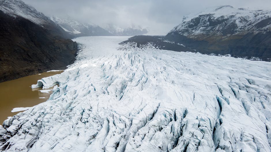
Drones Scanning Earth’s Glaciers Are Paving the Way for Future Mars Helicopters – Image for illustrative purposes only (Image credits: Pexels)
Researchers have turned to drones equipped with ground-penetrating radar to map the hidden boundaries beneath debris-covered glaciers on Earth. These tests address a key limitation in studying similar ice formations on Mars, where orbiting instruments struggle to pinpoint the divide between ice and overlying rock.[1][2] The approach promises higher-resolution data vital for future missions seeking accessible water on the Red Planet.
Mars’ Mid-Latitude Ice Deposits Pose Detection Hurdles
Glaciers dot Mars’ mid-latitudes, preserved under layers of rocky debris that shield them from the planet’s thin atmosphere. The Mars Reconnaissance Orbiter’s SHARAD instrument detected these features years ago, revealing vast ice reserves potentially useful for science and human exploration.[1] However, SHARAD’s orbital vantage point – about 300 kilometers high – lacks the resolution to delineate the precise boundary between the glacier ice and the accumulated regolith.
This gap matters for practical reasons. Debris thickness determines drilling feasibility for in-situ resource utilization, such as extracting water for fuel or life support. Without finer details, mission planners risk targeting sites buried under excessive rock. Orbital radars excel at broad surveys but falter on the “nitty-gritty” subsurface specifics required for targeted operations.[1]
Field Trials Over Remote Earth Analogs
A team from the University of Arizona’s Lunar and Planetary Laboratory tested the solution on debris-covered glaciers resembling those on Mars. They selected Sourdough Rock Glacier in Alaska and Galena Creek Rock Glacier in Wyoming, sites with prior ground-based data for validation. Researchers endured mosquito swarms, boulder fields, and off-road treks to deploy their equipment.[2]
The core tool was a DJI Matrice 600 Pro drone fitted with a MALA Geodrone 80 MHz ground-penetrating radar module. An automated terrain-following system guided flights over uneven landscapes, avoiding manual control pitfalls. The setup allowed surveys closer to the surface than satellites, capturing higher-resolution profiles while navigating areas too hazardous for foot travel.[1] Lead author Roberto Aguilar noted the practical lessons: optimal altitude, speed, flight direction aligned with glacier flow, and radar alignment for ice detection.[2]
Key Field Challenges Overcome:
- Mosquito-infested hikes in Alaska.
- Boulder-strewn approaches in Wyoming.
- Clutter from trees and valley walls filtered via 3D simulations.
- Power management with on-site generators.
Results Confirm Accuracy Across Sites
The drone radar delivered measurements that aligned closely with prior ground-based surveys and direct excavations. At Sourdough Rock Glacier, it recorded an ice thickness of 28.5 meters and average debris cover of 1.5 meters. Galena Creek Rock Glacier showed 48.6 meters of ice, with debris ranging from 0.8 to 1.3 meters in tested zones.[1]
Beyond thickness, the system imaged internal ice purity and embedded rocky layers, records of past climate cycles spanning centuries. Simulations ensured signals originated from subsurface ice, not surface distractions. Though the 80 MHz frequency struggled with the shallowest debris and deepest bedrock – compared to lower-frequency ground systems – the results proved the method’s reliability.[2]
| Site | Ice Thickness (m) | Debris Thickness (m) |
|---|---|---|
| Sourdough Rock Glacier, Alaska | 28.5 | 1.5 (mean) |
| Galena Creek Rock Glacier, Wyoming | 48.6 | 0.8-1.3 |
Toward Aerial Surveys of Martian Glaciers
This proof-of-concept bridges orbital and ground observations, filling a critical gap for Mars exploration. Drones could scout optimal drilling sites, avoiding blind excavations through unknown debris depths. Aguilar emphasized the value: “If you want to make decisions about where to drill on Mars, you need to know if the ice you’re trying to find is under one meter of debris or 10.”[2]
The technology draws from Ingenuity’s success and aligns with concepts like the Mars Science Helicopter, capable of carrying such payloads over glacial fields. While promising, limitations persist: the tested frequency suits many terrains but not all, and Martian adaptations must account for thinner air and dust. Still, these Earth trials equip future missions to tap Mars’ buried water reserves more efficiently.
Drone radar now stands ready to transform how scientists pierce planetary ice veils, starting with proven Earth successes.