
‘One of the most rapid transitions that I’ve seen’: NOAA forecaster on how this year’s El Niño could shatter records – Image for illustrative purposes only (Image credits: upload.wikimedia.org)
The transition from prolonged La Niña conditions to El Niño in the equatorial Pacific has unfolded at a pace rarely witnessed, drawing attention from climate scientists. Nathaniel Johnson, part of NOAA’s El Niño forecasting team, characterized it as “one of the most rapid transitions that I’ve seen.”[1][2] This swift shift raises questions about the event’s potential intensity and its place among historic benchmarks.
Why This Transition Stands Out
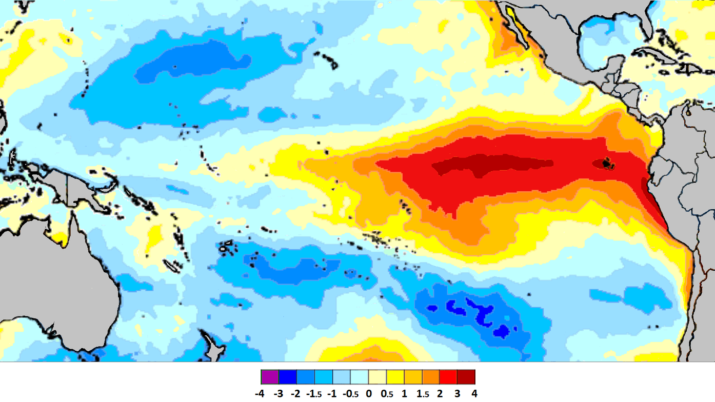
Forecasters track sea surface temperatures across the tropical Pacific to detect El Niño patterns, defined by sustained warming above average levels. The recent move followed years of cooler-than-normal waters associated with La Niña, making the reversal particularly notable.[3] NOAA’s June 2023 update confirmed the arrival of El Niño conditions after mounting evidence of warming.[3]
Such quick changes challenge typical ENSO cycle expectations, where phases often linger for months or years. Johnson noted the speed could mark it as the fastest on record, underscoring the unpredictability of ocean-atmosphere interactions.
Insights from NOAA’s Forecasting Efforts
Nathaniel Johnson serves on NOAA’s team monitoring El Niño-Southern Oscillation (ENSO), leveraging models and observations from satellites and buoys. His work at the Geophysical Fluid Dynamics Laboratory contributes to probabilistic outlooks that guide global preparations.[4] In interviews and updates, he has emphasized evolving conditions pointing toward significant warming.
The team’s assessments integrate data from multiple sources, including subsurface ocean heat content. This holistic approach helped identify the rapid buildup, with odds of a strong event climbing above 50% at peak forecasts.[3]
Placing It in Historical Context
Transitions from multi-year La Niña to El Niño remain uncommon, as cooler phases typically persist before flipping. Research highlights how such shifts can lead to abrupt atmospheric responses, amplifying the warming signal.[5] The 2023 event echoed rare precedents but accelerated beyond many analogs.
Compared to stronger past El Niños like 1997-98 or 2015-16, the onset speed sets this one apart, even if peak strength varied. NOAA records show few instances matching this velocity, reinforcing Johnson’s observation.[6]
Global Repercussions of a Record Pace
Rapid El Niño development often correlates with heightened weather variability worldwide. Drier conditions plagued parts of the U.S. Southwest, while heavier rains struck others, illustrating the pattern’s reach.[7]
- Australia and Southeast Asia faced flood risks from shifted storm tracks.
- Hurricane activity in the Atlantic subdued due to increased wind shear.
- Global temperatures surged, contributing to record warmth in subsequent months.[8]
Looking Ahead to ENSO Dynamics
Following the 2023-24 El Niño, the Pacific entered neutral and then La Niña phases, but forecasts now signal another potential warming by mid-2026.[9] NOAA continues refining indices to account for warming baselines, ensuring accurate tracking amid climate change.
This episode serves as a reminder of ENSO’s influence on extremes, with Johnson’s insight highlighting the value of vigilant monitoring. As oceans evolve, such rapid pivots may become more scrutinized for their role in compounding risks.